Nepal's Annapurna Circuit: The Complete Trekking Guide

Nepal's Annapurna Circuit: The Complete Trekking Guide

James Chen

October 6, 2025

6 min read· 65 views
Thorong La Pass looms at 5,416 meters. Your lungs burn. Your legs shake. But crossing this legendary threshold on the Annapurna Circuit delivers the ultimate high-altitude rush. This classic 14-day trek loops around the Annapurna massif, offering supremely varied scenery from subtropical jungles to alpine desert, and final jaw-dropping views from Nepal's most challenging trekking pass.

Getting There and Starting Point

How to reach Besisahar and prepare
Your gateway to the circuit is Besisahar, roughly 6-7 hours east by jeep or bus from Kathmandu. The journey twists along the Marshyangdi River, with plenty of photo stops. I recommend arriving a day early in Kathmandu; try Thamel's crowded streets for last-minute gear like down jackets (approx. NPR 3,000–5,000) or trekking poles (NPR 1,500–2,000). Permits are essential: the Annapurna Conservation Area Permit (ACAP) and a TIMS card, available at the Nepal Tourism Board on Tahachal Road. They cost around NPR 3,000 combined.
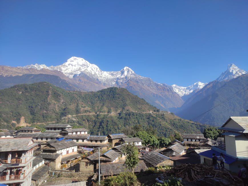
Gorgeous morning view of Ghandruk Village in Nepal, set against the stunning backdrop of the Annapurna mountains.

Besisahar Bazaar

lively market town with teahouses and local shops, the launchpad for your adventure.

Plan your trip with AI

Turn inspiration into a real itinerary. Plan day-by-day routes, find the best spots, and share with friends.

Day-by-Day Breakdown of the Annapurna Circuit

Your daily trail guide with highlights and logistics

Day 1: Besisahar to Bahundanda (1,130m). Start your trek on a gentle gravel road hugging the Marshyangdi River. The trail passes rice paddies and rural villages. Bahundanda is a small village with basic teahouses; expect a simple dal bhat for NPR 300-400. It's a good warm-up day, with about 5-6 hours of hiking.
Day 2: Bahundanda to Chamje (1,430m). The forests deepen here, with rhododendrons and oaks. Chamje's cluster of lodges offer hot showers (NPR 100) and wifi, but expect basic facilities. The trail is still moderate, but your lungs start adjusting to thinner air.
Day 3: Chamje to Bagarchhap (2,160m). Now you're trekking higher. The path steepens through pine forests and terraced fields. Bagarchhap is a quaint village, famous for its Mani walls and quaint stone houses. I found a cozy teahouse with yak butter tea that tastes like liquid gold after a long day.
Day 4: Bagarchhap to Chame (2,710m). The trail climbs steadily alongside the Marsyangdi River's canyon walls. Chame is the district headquarters with a small market and several teahouses. I recommend trying Thukpa, the Tibetan noodle soup, for a warming meal.
Day 5: Chame to Pisang (3,250m). The landscape begins to change: terraced fields give way to rocky slopes. From Pisang, you can visit the Pisang Monastery on a short side trek. This day's hike is 5-6 hours with good acclimatization opportunities.
Day 6: Pisang to Manang (3,510m). You enter the Manang Valley, a crucial acclimatization spot. Manang town has plenty of teahouses, bakeries, and even a small internet cafe. I spent a rest day here, hiking to the Ice Lake nearby to help my body adjust.
Day 7: Rest day in Manang. Vital for altitude acclimatization. Hydrate well and take a short hike to Gangapurna Glacier or the Tilicho Lake side trip if you're ambitious. Remember: don't rush at altitude.
Day 8: Manang to Yak Kharka (4,050m). The trail narrows, wind picks up, and the air thins noticeably. Yak Kharka is a yak herders' settlement with simple lodges. Brace yourself for colder nights and thinner air.
Day 9: Yak Kharka to Thorong Phedi (4,540m). Close to the high pass base, this short day prepares you for the big climb ahead. The ground is rocky and barren. I remember pausing at Thorong Phedi, feeling the cold seep into my bones but excited for the next day's ascent.
Day 10: Thorong Phedi to Muktinath via Thorong La Pass (5,416m). The longest, toughest day. You start hiking around 3-4 a.m., flashlight in hand, battling freezing winds and altitude. The pass is a heart-stopping ridge with snow and ice. Summiting feels like conquering the world. After a brief rest, the steep descent to Muktinath is a test for knees and nerves.
Day 11: Muktinath to Jomsom (2,720m). After the grueling pass, a steep, dusty downhill trail leads to Jomsom, a dusty bazaar with shops and cafes. I treated myself to fresh apple pies here; Jomsom apples are famous and worth every rupee (approx. NPR 150).
Day 12: Jomsom to Tatopani (1,190m). The landscape shifts dramatically to subtropical forests. Tatopani is famous for its hot springs, perfect for soothing tired muscles after days on the trail (entry around NPR 100).
Day 13: Tatopani to Ghorepani (2,860m). A tough climb back up to the hills. Ghorepani is your gateway to Poon Hill, a prime sunrise viewpoint over the Annapurna range.
Day 14: Ghorepani to Nayapul and return to Pokhara. Poon Hill's sunrise is worth waking up at 4 a.m. for. The panorama of Annapurna South, Dhaulagiri, and Machapuchare is remarkable. Afterward, descend to Nayapul and take a jeep or bus to Pokhara for celebrations and rest.

Essential Tips for the Annapurna Circuit

  • 1

    Acclimatize Properly - Use rest days wisely and never ascend more than 300-500 meters in a day above 3,000m.

  • 2

    Stay Hydrated - Drink at least 4 liters of water daily; dehydration worsens altitude sickness.

  • 3

    Pack Smart - Layered clothing, water purification tablets, and sturdy trekking boots are must-haves.

  • 4

    Book Teahouses Early - Especially in peak season (Sept-Nov and Mar-May), accommodations fill fast.

  • 5

    Carry Cash - ATMs are sparse beyond Manang; carry at least NPR 15,000 for the trek.

  • 6

    Don't Underestimate Weather - Nights can plummet below freezing; pack a 3-season sleeping bag.

Did you know?

The Thorong La Pass is one of the highest trekking passes in the world at 5,416 meters, and it attracts over 30,000 trekkers annually.

Altitude Sickness Prevention

How to stay safe above 3,000 meters

Altitude sickness is the real villain on this trek. I recall my second time on the Circuit when a fellow trekker ignored symptoms and had to be helicoptered out from Thorong La. The key signs are headaches, nausea, dizziness, and fatigue. The best prevention is slow ascent, hydration, and rest days. Some use Diamox, but consult your doctor beforehand. Listen to your body, and if symptoms worsen, descend immediately.

Good to Know

The Annapurna Conservation Area requires trekkers to use teahouses; wild camping is discouraged and sometimes banned to protect fragile ecosystems.

Teahouse Logistics and Costs

Where to stay, what to expect, and how much to budget
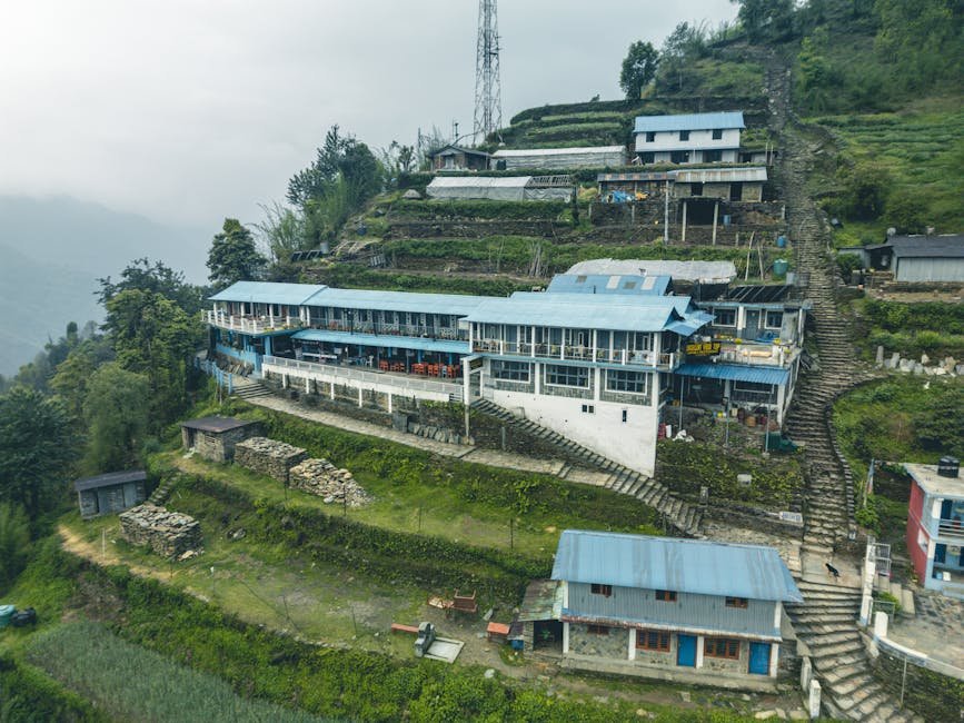
Teahouses line the Annapurna Circuit at almost every village, providing basic dorm beds (NPR 300-600) or private rooms (NPR 700-1,200). Expect simple heating with wood stoves, squat toilets, and limited hot water. Food menus are surprisingly consistent: dal bhat (rice and lentils) is the staple, costing around NPR 300-400 per meal. Snacks like momos and noodles range from NPR 150-300. Wifi is patchy and usually costs extra.
A picturesque view of terraced buildings in Ghandruk, Gandaki Province, Nepal.

Typical Annapurna Circuit Teahouse

Rustic, welcoming lodges where trekkers swap stories over steaming cups of chai.

Side Trip to Tilicho Lake

A stunning detour above Manang

If you have an extra 3-4 days and the legs for it, the Tilicho Lake side trip is a must. At 4,919m, Tilicho is one of the highest lakes in the world. The hike from Manang is challenging: rocky trails, steep ascents, and unpredictable weather. I got lost for a half hour on this route, but the turquoise lake cradled by snowy peaks made every stumble worth it. Be sure to pack extra layers and start early from Manang to avoid afternoon storms.
SeasonWeatherTrail ConditionsCrowdsPrice Range (NPR/day)
Spring (Mar-May)Mild, occasional rainTrail mostly dry, rhododendrons bloomHigh1500-2000
Summer/Monsoon (Jun-Aug)Heavy rain, slippery trailsRisk of landslides, leeches commonLow1000-1500
Autumn (Sep-Nov)Clear skies, cool temperaturesBest trail conditionsHigh1500-2200
Winter (Dec-Feb)Cold, snow patches above 3,500mSome sections icy, fewer servicesLow1200-1800
Pros
  • Unmatched Himalayan panoramas and cultural diversity
  • Well-established trail with teahouses and permits
  • High adrenaline moment at Thorong La Pass
Cons
  • Risk of altitude sickness requires careful acclimatization
  • Variable weather can cause trail closures or delays
  • Teahouses can be crowded and basic during peak season
Packing for the Annapurna Circuit requires balance: enough gear to tackle cold and altitude without lugging unnecessary weight. I always bring a lightweight down jacket, waterproof shell, thermal base layers, and a sturdy pair of hiking boots with ankle support. Trekking poles are lifesavers on steep descents. A headlamp is essential for early starts over Thorong La Pass. Don't forget sunscreen and lip balm; the high-altitude sun is brutal.

Final Thoughts

Why you should take on the Annapurna Circuit now

The Annapurna Circuit is more than a trek; it's a rite of passage for any adventurer. I've felt the exhaustion, the awe, and that indescribable joy of standing above the clouds at Thorong La. Each village, each meal, every step up the trail tells a story of resilience and natural grandeur. Don't let the technicalities scare you off: prepare, respect the mountain's power, and this trek will reward you with memories that last a lifetime. Lace up your boots,

James Chen

Travel Editor at Vitano Magazine
You might also enjoy

Surfing Portugal's Silver Coast: From Ericeira to Nazaré
Adventure4 min

Surfing Portugal's Silver Coast: From Ericeira to Nazaré

If you’re chasing waves in Europe, Portugal’s Silver Coast is where it’s at. From beginner-friendly breaks to some of the world’s gnarliest big waves, this stretch between Ericeira and Nazaré offers a raw, salty ride alongside charming fishing villages, lively surf camps, and an endless Atlantic soundtrack. Pack your board, mate - we're hitting the road and the water!

DV
Diego Vargas
04/21/2026
Via Ferrata in the Dolomites: A Beginner's Guide to Iron Paths
Adventure4 min

Via Ferrata in the Dolomites: A Beginner's Guide to Iron Paths

At 2,500 meters above sea level, clipped into steel cables with nothing but a harness and your wits between you and a steep drop, the Dolomites’ via ferrata roads offer a raw, exhilarating taste of alpine adventure. Whether you're a first-timer or a hardened climber, navigating these iron paths rewards you with vertigo-inducing views, adrenaline jolts, and an unforgettable connection to the mountains. I’ve done 12 via ferratas here; this guide cuts through the hype with real-world insights on the best routes, gear rentals, rifugio stays, and what to expect when you sign on for your first climb.

MB
Marcus Berg
04/21/2026
Diving the Cenotes: Mexico's Underwater Cathedral
Adventure5 min

Diving the Cenotes: Mexico's Underwater Cathedral

Mate, if you ever find yourself cruising through Mexico’s Yucatán Peninsula and you’re craving a dive unlike any other, the cenotes are calling your name. These crystal-clear freshwater caves aren’t just beautiful; they’re a peek into ancient Mayan mythology and a playground for adventurers like me. I spent weeks exploring them, and honestly, every splash felt like entering an underwater cathedral carved by time.

DV
Diego Vargas
12/18/2025